
Merrick Butte: Difference between revisions
m 1 revision imported from wikipedia:en:Merrick_Butte |
No edit summary |
||
| Line 2: | Line 2: | ||
{{Infobox mountain | {{Infobox mountain | ||
| name = Merrick Butte | | name = Merrick Butte | ||
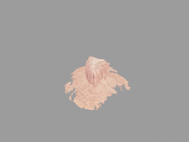
| photo = | | photo = File:Monument_valley_-_merrick_butte.glb | ||
| photo_caption = | | photo_caption = | ||
| elevation_ft = 6206 | | elevation_ft = 6206 | ||
Latest revision as of 17:18, 17 August 2025
| Merrick Butte | |
|---|---|
 | |
| Highest point | |
| Elevation | 6,206 ft (1,892 m) NAVD 88[1] |
| Prominence | 966 ft (294 m)[1] |
| Coordinates | Lua error in Module:Coordinates at line 489: attempt to index field 'wikibase' (a nil value).[2] |
| Geography | |
Lua error in Module:Location_map at line 411: Malformed coordinates value.
| |
| Location | Navajo County, Arizona. U.S. |
| Topo map | USGS Mitten Buttes |
Merrick Butte is a butte located in Monument Valley[3] and is part of the Monument Valley Navajo Tribal Park, similar to its neighbors West and East Mitten Buttes just to the north.[4] It was named after silver miner Jack Merrick, killed by Native Americans in 1880.
References
- ↑ 1.0 1.1 "Merrick Butte". Peakbagger.com. Retrieved 2016-08-22.
- ↑ "Merrick Butte". Geographic Names Information System. United States Geological Survey, United States Department of the Interior. Retrieved 2016-08-22.
- ↑ Mitten Buttes Quadrangle, Arizona-Utah, 7.5 Minute Series, US Geological Survey, 1738 ed.
- ↑ Arizona Atlas & Gazetteer, De Lorme, 4th ed., 2001, p. 26 ISBN 0-89933-325-7
External links
 Media related to Lua error in Module:Commons_link at line 62: attempt to index field 'wikibase' (a nil value). at Wikimedia Commons